 Milford Sound Boat Tour
Where Is Milford Sound? The Map, the Location, the One Road In
Where is Milford Sound? It sits on the south-west corner of New Zealand's South Island, inside Fiordland National Park, 15 kilometres from the open Tasman Sea. This page puts the sound on the map: distances to Te Anau, Queenstown and Invercargill, the single road in, the airstrip at its head, and the layout of the fiord from the cruise terminal to the sea. For the drive stop by stop, see the Milford Road guide. For a full day plan, see Queenstown to Milford Sound. To compare boats on the water, start at Milford Sound boat tours.
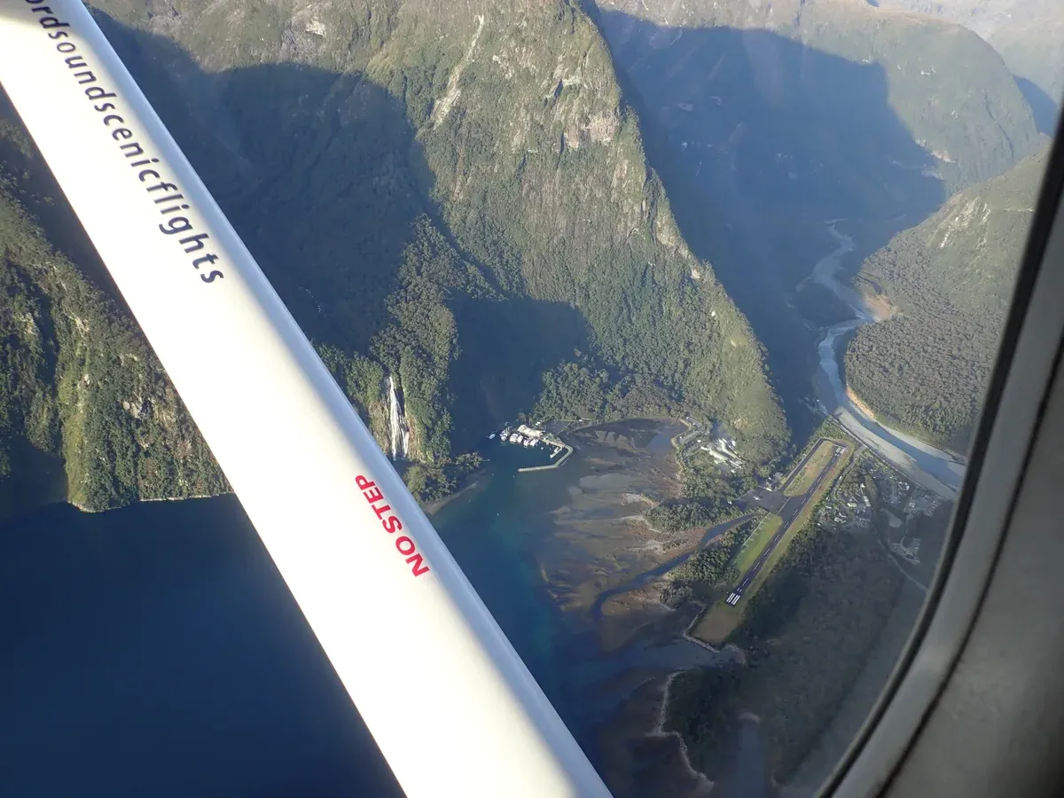
A view from the air of the runway at Milford Sound. Photo: RupertDesign, CC BY-SA 4.0, via Wikimedia Commons
Quick answer Milford Sound's location
Milford Sound (Piopiotahi) is on the south-west coast of New Zealand's South Island, in Fiordland National Park, 120 km from Te Anau by road and about 288 to 291 km from Queenstown. It is a fiord carved by glaciers, running 15 km inland from the Tasman Sea. One road reaches it, State Highway 94, and one 782 m airstrip sits at its head.
Key takeaways
- The nearest town is Te Anau, 120 km and at least 2 hr 15 min of driving away, per the Milford Road guide.
- From Queenstown the drive is 288 to 291 km and takes almost four hours by one count and up to 5 by another, or skip the wheel with a Coach and Cruise from Queenstown at $148 per person.
- See how the fiord is laid out and what you see from the boat before you choose a cruise.
- Doubtful Sound, the larger neighbour, has no direct road. Compare them in Milford Sound vs Doubtful Sound.
Milford Sound and the Road In on One Map
Milford Sound sits at the end of a single road from Te Anau. The map holds the terminal, the airstrip, the lodge, the walks at the fiord and every stop and DOC campsite on the way in. Bubbles grow with the number of tours on this site that name the place.
-
Te Anau
2 of the toursTe Anau is the last town with petrol, food and accommodation before Milford Sound, 120 km away.
Stops here: Award Winning Milford Sound Full Day Tour & Cruise from Te Anau, Full-Day Milford Sound Tour with Cruise and Walks from Te Anau
-
Te Anau Downs
No tourTe Anau Downs is 28 km from Te Anau and the boat departure point for the Milford Track.
No guided tour stops here. Self-drive only.
-
Lake Mistletoe
No tourLake Mistletoe is a 45 minute return forest walk at Te Anau Downs.
No guided tour stops here. Self-drive only.
-
Henry Creek Campsite
No tourDOC lists Henry Creek as a lakeside campsite with capacity 40, 25 km north of Te Anau by its own guide.
No guided tour stops here. Self-drive only.
-
Walker Creek Campsite
No tourSmall DOC campsite beside the Eglinton River, capacity 5.
No guided tour stops here. Self-drive only.
-
Tōtara Campsite
No tourDOC campsite south of Mirror Lakes in beech forest, capacity 20.
No guided tour stops here. Self-drive only.
-
Mackay Creek Campsite
No tourDOC campsite with Eglinton valley views and fly fishing, capacity 15.
No guided tour stops here. Self-drive only.
-
Eglinton Valley
1 of the toursDOC's Eglinton Valley stop at 52 km has panels on the valley's geology and history.
Stops here: Premium Milford Sound Small Group Tour & Cruise from Queenstown
-
Mirror Lakes
2 of the toursMirror Lakes is a 10 minute boardwalk with views of the Earl Mountains.
Stops here: Premium Milford Sound Small Group Tour & Cruise from Queenstown, From Queenstown Milford Sound Cruise & Glass-Roof Coach Tour
-
Deer Flat Campsite
No tourDOC campsite beside the Eglinton River that floods regularly, capacity 15.
No guided tour stops here. Self-drive only.
-
Knobs Flat
1 of the toursKnobs Flat has the last flush toilets before Milford Sound and accommodation.
Stops here: From Queenstown Milford Sound Cruise & Glass-Roof Coach Tour
-
Kiosk Creek Campsite
No tourSmall DOC campsite with views of glacial moraine, capacity 10, bring own drinking water.
No guided tour stops here. Self-drive only.
-
Upper Eglinton Campsite
No tourSmall DOC camping area, capacity 3, not suitable for large vehicles.
No guided tour stops here. Self-drive only.
-
Cascade Creek / Lake Gunn Nature Walk
No tourDOC's Cascade Creek campsite (capacity 120) is the start of the Lake Gunn Nature Walk.
No guided tour stops here. Self-drive only.
-
Lake Gunn
No tourLake Gunn is 79 km from Te Anau at 480 m elevation.
No guided tour stops here. Self-drive only.
-
Lake Fergus car park
No tourLake Fergus is a roadside stop on SH94 near The Divide.
No guided tour stops here. Self-drive only.
-
The Divide
No tourThe Divide is the lowest east-west pass in the Southern Alps at 531 m.
No guided tour stops here. Self-drive only.
-
Key Summit
No tourKey Summit is a 3 hour return walk from The Divide.
No guided tour stops here. Self-drive only.
-
Hollyford Valley Lookout (Pops View)
No tourPops View at 85 km has views of the Hollyford Valley.
No guided tour stops here. Self-drive only.
-
Lake Marian
No tourLake Marian is reached via the Hollyford Road track, 3 hr 30 min return.
No guided tour stops here. Self-drive only.
-
Humboldt Falls
No tourHumboldt Falls is a 30 minute return walk off the Lower Hollyford Road.
No guided tour stops here. Self-drive only.
-
Monkey Creek
1 of the toursMonkey Creek is a pull-over with a good chance of whio and kea.
Stops here: From Queenstown Milford Sound Cruise & Glass-Roof Coach Tour
-
Gertrude Valley / Saddle
No tourGertrude Saddle is a 4-6 hour return expert route from the Gertrude Valley carpark.
No guided tour stops here. Self-drive only.
-
Homer Tunnel (east portal)
2 of the toursThe Homer Tunnel is 1.2 km long at 945 m and opened in 1953.
Stops here: Premium Milford Sound Small Group Tour & Cruise from Queenstown, From Queenstown Milford Sound Cruise & Glass-Roof Coach Tour
-
The Chasm
No tourThe Chasm is a 20 minute return walk to powerful waterfalls.
No guided tour stops here. Self-drive only.
-
Tutoko Suspension Bridge
No tourBuilt in 1940, the bridge completed the road into Milford Sound.
No guided tour stops here. Self-drive only.
-
Deepwater Basin
No tourDeepwater Basin is the kayak and overflow-parking base with a free shuttle.
No guided tour stops here. Self-drive only.
-
Milford Sound Visitor Terminal
6 of the toursThe Milford Sound cruises on this site leave from here, a 10 minute walk from the car park.
Stops here: Milford Sound: 2-Hour Small Boat Scenic Cruise, Milford Sound: Nature Cruise on a Modern Catamaran, Milford Sound: Nature Cruise - Grand Views & Optional Lunch, Milford Sound: Boutique Small-Boat Cruise, Milford Sound: Classic and Signature Cruises, Milford Sound: Overnight Cruise with Water Activities
-
Milford Sound Lodge
No tourThe only accommodation at Milford Sound.
No guided tour stops here. Self-drive only.
-
Milford Sound Airport
3 of the toursSingle 782 m asphalt runway, used for scenic flights and charters.
Stops here: Milford Sound Flight and Cruise Tour from Queenstown, From Queenstown: Milford Sound Full-Day Trip by Plane & Boat, Milford Sound Flight & Cruise Day Trip from Queenstown
-
Bowen Falls
No tourLady Bowen Falls drops 162 m beside the terminal. DOC lists the walk to it as closed, so you see it from the boat.
No guided tour stops here. Self-drive only.
-
Milford Foreshore Walk
No tour30 minute easy shoreline stroll from the main car park.
No guided tour stops here. Self-drive only.
-
Milford Sound Lookout Track
No tour10 minute walk with steps to a lookout behind the cafe.
No guided tour stops here. Self-drive only.
Where Milford Sound Is
Milford Sound sits in the south-west of New Zealand's South Island, inside Fiordland National Park, the country's largest national park at 12,607 square kilometres.
Distances on the Map
Everything on this map hangs off State Highway 94 and the town of Te Anau. The figures below come from official tourism and transport sources, and sources differ slightly on a couple of distances, so both figures are given. No rail line and no second road reaches the fiord.
The table shows every distance the sources state.
| From | Distance | By road | By air |
|---|---|---|---|
| Te Anau | 120 km (DOC count, other sources say 117 km or 121 km) | At least 2 hr 15 min without stops | Not stated |
| Queenstown | 288 km to 291 km depending on the source | Almost four hours, allow 5 | 30-40 minutes one way, per Queenstown Airport |
| Invercargill | 278 km | About four hours | Not stated |
| Manapouri | Not stated. Not stated. About 20 km from Te Anau, the base for Doubtful Sound | About 20 minutes from Te Anau | Not stated |
The Geography in Plain Words
Milford Sound is one of the 15 fiords in Fiordland National Park, which was established in 1952 and forms part of the Te Wāhipounamu World Heritage area, inscribed in 1990. Despite the name, it is a fiord, a valley carved by glaciers thousands of years ago and then flooded by the sea, not a river valley like a true sound. The Māori name is Piopiotahi and the official name is Milford Sound / Piopiotahi.
The fiord runs 15 km inland from the Tasman Sea, is up to 1.94 km wide, covers about 25 square kilometres and reaches a maximum depth of 291 metres by one count, with DOC describing underwater depths of up to 265 m. Rock faces on either side rise 1,200 metres or more. Captain John Grono is credited with the first European sighting around 1812, and the place was named after Milford Haven in Wales.
Māori had visited more than 1,000 years earlier. Rudyard Kipling called it the eighth Wonder of the World. The park around it is wet: rainfall exceeds seven metres in many parts of Fiordland.
DOC says Piopiotahi draws over a million visitors a year, while Wikipedia says well over half a million people visit Fiordland National Park, most of them in the Te Anau to Milford Sound corridor.
The Fiord from End to End
A Milford Sound cruise runs the length of the fiord and back, roughly 15 km each way. Here is what the map shows from the boat terminal out to the Tasman Sea, in the order you pass it.
Terminal to Bowen Falls
Cruises leave from the visitor terminal, a 10-minute walk from the main car park via a covered walkway. Lady Bowen Falls comes early, the tallest waterfall here at about 162 metres by the most common count, though one source gives 160 m and another 161 m. The Bowen River that feeds it supplies electricity and drinking water for the village.
On the foreshore near the terminal, the Piopiotahi Milford Foreshore Walk takes 30 minutes and the Milford Lookout Walk takes 10 minutes.
Mitre Peak and the Mid-Fiord
Mitre Peak rises from the water, its height given as 1,692 m by DOC and 1,683 m by another source. The Mitre Peak Small Boat Cruise passes it. Across the water, The Elephant peak stands 1,517 metres and The Lion peak 1,302 metres.
Harrison Cove is the first place settlers anchored in the sound and is where the Milford Mariner anchors overnight. Guides cover Mitre Peak and Milford Sound kayaking in detail.
Stirling Falls to the Tasman Sea
Stirling Falls drops about 151 to 155 metres depending on the source, and Southern Discoveries says its boats position within metres of the base. Further towards the mouth sits Seal Rock, where fur seals haul out. The Mitre Peak Small Boat Cruise route goes as far as St Annes Point Lighthouse, and the Tasman Sea lies 15 km from the head of the fiord.
The Glass-Roof Catamaran Cruise at $93 per person runs the length of the fiord in 105 minutes. Rain days bring hundreds of temporary waterfalls down walls that rise 1,200 metres or more, and the Milford Sound waterfalls guide lists the lot.
One Road, One Airstrip
Only two ways in exist, and both are worth understanding before you book. There is no ferry, no railway and no coastal road.
The Road In
State Highway 94, the Milford Road, is the only road. The Milford Road section runs 119 km from Te Anau, and SH94 as a whole covers 254.4 km from Gore to Milford Sound. It is fully sealed but narrow and winding, with injury crash rates about 65 percent higher than the rest of New Zealand's network.
Its highest point is the Homer Tunnel, 99 km from Te Anau, at 945 m above sea level and about 1.2 km long, opened in 1953 after construction began in 1935. The road itself was first surveyed in 1890. Traffic lights control the tunnel in peak summer and waits can reach 20 minutes.
There are no fuel stops between Te Anau and the sound, no mobile coverage along the road, and the road closes an average of 8 days a year, mostly in winter when avalanche danger closes the Marian Corner gates. Between May and November, or June to November by Milford Sound Lodge's count, vehicles must carry or fit snow chains when required, hireable at any Te Anau petrol station. The stop-by-stop detail lives in the Milford Road guide, and the Queenstown to Milford Sound page plans the full day.
If driving does not appeal, the Coach and Cruise from Queenstown at $148 per person covers the 288 to 291 km in 12 hours with scenic stops and hotel pickup.
The Airstrip and the Track
Milford Sound Airport sits at the head of the fiord with a single 782 m asphalt runway at 3 m above sea level, taking aircraft up to twin-engine size. The first landing came on 17 November 1938. Daily charter flights run weather permitting to Queenstown and Wānaka, mostly Cessna Caravan and GA8 Airvan aircraft, and Queenstown Airport lists ten flight operators for the route.
The flight from Queenstown typically takes 30 to 40 minutes one way, and Fly-Cruise-Fly from Queenstown at $467 per person is listed at 5 hours. Walkers arrive differently: the Milford Track ends at Sandfly Point, with a boat trip across to the village. DOC splits it into legs of 5 km, 17.5 km, 13 km and 18 km over 4 days and 3 nights, about 53.5 km in all, with the Great Walk season running November to April and hut fees of NZ$106 per night for New Zealand adults and NZ$152 for international adults in season.
It cannot be walked as a day walk.
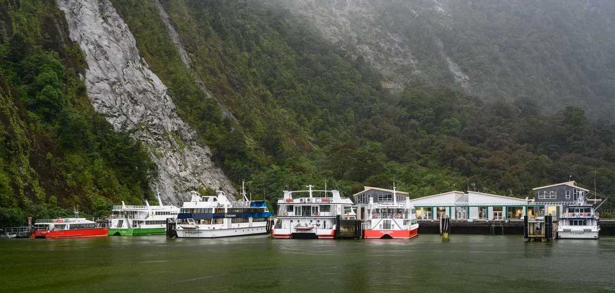
Milford Sound in New Zealand. Photo: Bengt Nyman, CC BY 2.0, via Wikimedia Commons
Doubtful Sound and the Other Fiords
Milford Sound is one of Fiordland's 15 fiords, but the map shows a much larger neighbour to the south.
Doubtful Sound
Doubtful Sound lies about 50 km from the village of Manapouri, the nearest inhabited place, and has no direct road in. Reaching it means a drive to Manapouri, a 45-minute boat crossing of Lake Manapouri and a 45-minute coach ride over the 671 m Wilmot Pass on a 21 km gravel road built for the power station between 1963 and 1965. It is a much bigger body of water: 40 km long, up to 421 m deep by one count and about 430 m by another, roughly three times longer and five times deeper than Milford Sound.
RealNZ calls it the second largest fiord in Fiordland, about ten times larger than Milford Sound. About 70 bottlenose dolphins live there. The Doubtful Sound Day Cruise at $179 per person takes 7 hours from Manapouri including the cruise.
The full comparison is in Milford Sound vs Doubtful Sound.
The Rest of Fiordland
Fiordland National Park contains 15 fiords, among them Milford, Doubtful and Dusky Sounds. Dusky Sound is another of the park's fiords. Lake Te Anau, on the road corridor, holds New Zealand's only three inland fiords: North, Middle and South Fiords on its western shore.
The park sits inside Te Wāhipounamu, a World Heritage area of 2,600,000 hectares inscribed in 1990 that stretches 450 km up the South Island's west coast and also takes in Aoraki/Mount Cook, Mount Aspiring and Westland Tai Poutini national parks. For what the comparison means in practice, see Milford Sound vs Doubtful Sound.
Frequently Asked Questions
How far is Milford Sound from Queenstown?
Between 288 and 291 km by road depending on the source, taking almost four hours of driving on narrow winding roads, with some operators recommending you allow 5 hours. A coach day trip makes it a 12-hour day. The day plan is in the Queenstown to Milford Sound guide.
Where exactly is Milford Sound on the map?
On the south-west coast of New Zealand's South Island, in Fiordland National Park, 15 km inland from the Tasman Sea and 120 km from Te Anau by road. It is one of the park's 15 fiords, as covered in the Fiordland National Park guide.
How do you get to Milford Sound?
By road on State Highway 94 from Te Anau, the only road in, by charter flight into the 782 m airstrip at the fiord's head, or on foot at the end of the Milford Track. The road route is detailed in the Milford Road guide and flights in the Milford Sound scenic flight guide.
Is Milford Sound one of the 7 Wonders of the World?
Not in the classic list of seven, but Rudyard Kipling called it the eighth Wonder of the World, a phrase still repeated. Its World Heritage protection comes through the Te Wāhipounamu area, part of the landscape you cross on the Milford Road.
How far is Milford Sound from Te Anau?
120 km by DOC's count, with other sources giving 117 km or 121 km, and the drive takes at least 2 hr 15 min without stops. There are no fuel stops on the way and no mobile coverage. Stops and fuel planning are in the Milford Road guide.
Can you drive to Doubtful Sound from Milford Sound?
No. There is no direct road into Doubtful Sound and no private vehicle can use the Wilmot Pass Road. Access is from Manapouri by boat across Lake Manapouri and a coach over the pass. The two fiords are compared in Milford Sound vs Doubtful Sound.